Analyse the
Infrastructure Pipeline
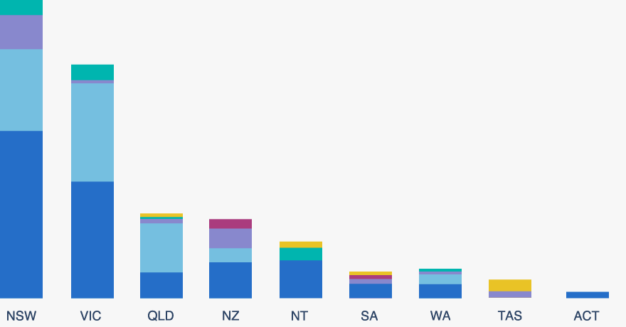
Our dynamic charts make it easy to get an up-to-date view of the Australia and New Zealand Infrastructure Pipeline. Pick one of the charts and filter by location, sector, status and procurement approach to explore the data behind the pipeline.
ANZIP charts
Major projects chart (coming soon) Infrastructure pipeline by status Infrastructure pipeline by locationAdditional charts by Infrastructure Partnerships Australia
Privatisations charts Public Private Partnerships chartPrivate Finance Analysis
Recent Updates
The NSW Government has announced the redevelopment of Penrith Stadium. The scope of the works includes:
- demolition of the western stand
- play facilities catering for both male and female sporting teams
- new amenities and food and beverage offerings
- refurbishment of the eastern stand
- new stadium entries, and
- warm up space on the western field.
Western Program Alliance (WPA) is one of the four ongoing program Alliances established by Victoria’s Major Transport Infrastructure Authority (MTIA) (previously, Level Crossing Removal Authority) to deliver the Level Crossing Removal Program.
The Alliance comprises:
- McConnell Dowell as the principal contractor
- Arup and Mott Macdonald as design partners, and
- Metro Trains Melbourn (MTM) as the network operator.
MTIA has allocated all level crossing removal sites, and incorporated rail upgrades to one of the four original program alliances, with formal contract awards occurring incrementally, subject to ongoing performance and provision of detailed works proposals and costings.
Allocated level crossing removals and other rail upgrades for WPA, with their status are below:
- Abbotts Road, Dandenong South (operational)
- Aviation Road, Laverton (operational)
- Cherry Street, Werribee (operational)
- Dandenong to Lynbrook duplication (under delivery)
- Greens Road, Dandenong South (operational)
- Werribee Street, Werribee (operational)
- Kororoit Creek Road, Williamstown (operational)
- Old Geelong Road, Hoppers Crossing (under delivery)
- Ferguson Street, Williamstown (under delivery)
- new North Williamstown Station (under delivery)
- Mount Derrimut Road, Deer Park (operational)
- Webster Street, Dandenong (detailed planning)
- Webb Street, Narre Warren (operational)
- Brunt Road, Beaconsfield (detailed planning), and
- new Narre Warren Station (operations).
Track duplication from Dandenong to Lynbrook and Greens Road level crossing removal were awarded as part of Cranbourne Cranbourne Line Upgrade (Package A).
The Auckland Airport Expansion - Transport Hub is one of the eight initial anchor projects identified in the Auckland Airport Expansion program and one of the four chosen to continue in the August 2021 Covid Reset Plan.
The Transport Hub will be a four-storey structure built on the footprint of the current international carpark. It will be connected to the international terminal and the upcoming new domestic terminal by an enclosed skybridge. It includes:
- a new covered pick-up/drop-off area
- valet services
- covered car parks, including electric vehicle charging stations, connected to the terminal by an enclosed pedestrian bridge, and
- 1.2 megawatts of rooftop solar panels.
The transport hub is expected to accommodate both commercial and public transport options.
Built to double height, the ground floor of the four-storey building will accommodate buses as well as cars, with the upper floors featuring smart car parking, electric vehicle charging stations and office spaces.
The Townsville University Hospital Expansion project will add an additional 143 beds to the existing facility.
The project’s scope of works includes construction of an eight-storey building for rehabilitation and surgery services, comprising:
- an additional 143-bed capacity
- 330 additional staff carparks
- acute and rehabilitation inpatient units
- operating theatres
- medical imaging, and
- a new helipad on level eight of the building.
The project aims to address growing demand for health services throughout the region and maintain health care for a growing population.
The Coomera Connector is a planned road transport network expansion over a 45-kilometre corridor between Loganholme and Nerang. The project will provide a new road link to the east of the M1 corridor, with new crossings of the Logan, Albert, Coomera and Nerang Rivers.
Delivery of the project is being planned in stages. Stage One involves the construction of a 16-kilometre of stretch of road, up to six lanes wide, east of the M1 between Coomera and Nerang.
Stage One of the project will also be divided into four stages:
- Stage One Early Works: including resumptions, investigations, environmental initiatives, PUP relocation works
- Stage One North: Shipper Drive to Helensvale Road
- Stage One Central: Helensvale Road to Smith Street Motorway, and
- Stage One South: Smith Street Motorway to Nerang Broadbeach Road.
Scope of Stage One work will include:
- high speed arterial road to complement the M1 and surrounding road network
- grade separated interchanges at Helensvale Road, Gold Coast Highway, Smith Street and Southport Nerang Road
- shared path to improve active transport
- noise barriers and landscaping will be an integral part of the design
- wildlife sensitive design and construction, and
- a highly constrained corridor.
Details of the remaining stages, nominally between Loganholme and Coomera, are yet to be announced.
This project is the proposed redevelopment of Canterbury Museum’s Rollerston Avenue site. The redevelopment is needed to protect the Museum’s heritage buildings and the 2.3 million objects in its collection, upgrade visitor facilities and improve the interior of the Museum to create a fit-for-purpose cultural facility.
Key aspects of the redevelopment include:
- improvements to the Robert McDougall Gallery Building including above-ground strengthening (commenced 2023)
- base isolation for the McDougall Building and development of new basement storage (commencing 2024 and expected completion mid-2025), and
- a new three-storey building which will include mezzanine floors, multifunctional spaces such as a new lecture theatre, and increased exhibition space.
The project will be delivered sequentially, starting with above-ground strengthening works and ending with the construction of the new museum building. Each of these stages will be contracted separately.
The project has an estimated total cost of NZ$205 million, including NZ$175 million for the Museum building, and NZ$30 million to develop new exhibitions.
Marinus Link will see a second undersea electricity connection constructed between Tasmania and Victoria, with supporting transmission infrastructure. Marinus Link is part of Project Marinus, which also comprises the North West Transmission Developments (NWTD). The project is being developed by TasNetworks, and would operate in addition to the existing Basslink interconnector.
The full scope of the project includes the delivery of 1.5 gigawatts of transmission lines between Burnie in Tasmania and Hazelwood in Victoria, with supporting network augmentations in Tasmania.
The project is being delivered over two stages:
- Stage One: the first 750-megawatt transmission line ($2.9 billion), which will be delivered alongside the NTWD Stage One, and
- Stage Two: a second 750-megawatt transmission line ($2.2 billion), which will be delivered alongside the remainder of the scope of the NTWD.
The components of the project include:
- around 250 kilometres of undersea cables
- 90 kilometres of underground cables, and
- converter stations at both ends.
Stage Two, comprising the second 750 MW HVDC cable, may proceed subject to market operators needs and development of additional dispatchable capacity in Tasmania.
The Queensland Government will develop three Renewable Energy Zones (REZs), located in northern, central and southern Queensland. The REZs are intended to encourage investment in renewable generation and storage projects.
Indicative locations of potential REZ development have been identified based on network capacity, project pipeline and land use analysis. There are currently 12 potential REZs in Queensland across the planning and in-flight phases.
Potential REZs include:
- Southern Queensland REZs - Southern Downs REZ (in-flight), Western Downs REZ (in-flight), Woolooga REZ (planning), Darling Downs REZ (planning), Tarong REZ (planning.)
- Central Queensalnd REZs - Callide REZ (planning), Calliope REZ (planning), Isaac REZ (planning), Capricorn REZ (planning).
- North and Far North Queensland REZs - Far North Queensland REZ (in-flight), Collinsville REZ (planning), Flinders REZ (planning).
These preliminary locations represent the REZ connection to the shared network, and as each REZ is declared for consultation and development, the specific locations will be further defined.
Learn how to make the most of ANZIP
Welcome to the Australian and New Zealand Infrastructure Pipeline platform, a search tool for infrastructure projects. The Beta version offers new exciting features as well as improved popular features like Map view. Simply go to 'Search' in the menu bar to access the map.
See more tips
Popular searches
Sponsors
Partners
SIGN IN TO ANZIP AND SUBSCRIBE TO THE PIPELINE REPORT
Sign in to make the most of ANZIP. Subscribe to the Pipeline Report, Infrastructure Partnership's monthly analysis of Pipeline data and project movements, review past editions of the report and keep track of your Saved Projects.
Sign up