Analyse the
Infrastructure Pipeline
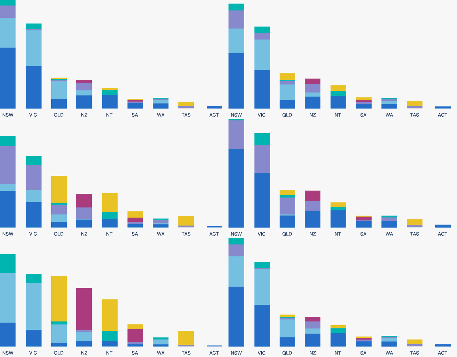
Our dynamic charts make it easy to get an up-to-date view of the Australia and New Zealand Infrastructure Pipeline. Pick one of the charts and filter by location, sector, status and procurement approach to explore the data behind the pipeline.
ANZIP charts
Infrastructure Pipeline By Status Infrastructure Pipeline By Location Pipeline Forecast By Expenditure Pipeline Forecast By Labour DemandAdditional charts by Infrastructure Partnerships Australia
Privatisations By Year Public Private Partnerships By Jurisdiction & YearPrivate Finance Analysis
Recent Updates
The New Zealand Transport Authority has proposed a 10-kilometre extension to State Highway One (SH1) north of Chirstchurch, including a six-kilometre bypass of Woodend.
The full scope of the project includes:
- an upgraded four-lane motorway between SH71 and Pineacres.
- a four-lane bypass of Woodend Town Centre
- a grade separated interchange (overpass) at the Williams Street intersection with SH1
- access to the local road networks
- overbridges at Woodend Beach Road and Gladstone Road to maintain these local connections
- widening of the existing bridge over the Kaiapoi River, and
- removal of the existing Cam River bridge and construction of three new bridges.
The redevelopment of the Bankstown-Lidcombe Hospital, also known as the New Bankstown Hospital, will include:
- enhanced emergency, critical care, medical and surgical services
- expanded, integrated ambulatory care services, including cancer treatment and community health services, and
- increased capacity for health services in local communities.
The NSW Government has confirmed the hospital will be built on the site where the TAFE NSW-Bankstown Campus is currently located. The existing TAFE campus will be relocated.
The new Rouse Hill hospital will include:
- construction of a hospital tower up to 11 storeys
- an emergency department
- birthing and maternity services
- operating theatres
- pathology, pharmacy and medical imaging services
- paediatrics and renal dialysis
- ambulatory treatment spaces
- outpatient clinics.
- construction of a 10-storey carpark with 659 car spaces
- pedestrian and cycle pathway connections, and
- internal roads with access from Commercial Road.
The Gold Coast Advanced Resource Recovery Centre (ARRC) is a proposed waste-to-energy (WtE) facility, located in Stapylton, Queensland. The project will be delivered using a Design, Build, Finance, Operate and Maintain (DBFOM) model.
The ARRC integrated waste and energy precinct is expected to comprise:
- garden and food organics composting facility
- a plastics, glass, paper and other recyclables facility
- the WtE facility, and
- community hub and innovation park with community education, and research capabilities.
Australia will begin building conventionally-armed, nuclear-powered submarines, the SSN-AUKUS, in Osborne, South Australia by the end of 2030. Construction will be supported by an expansion of the existing Osborne Naval Shipyard Area to support the facilities and infrastructure required to build the first SSN-AUKUS, referred to as the Submarine Construction Yard (SCY).
The preferred site for the SCY is situated north of the existing Osborne Naval Shipyard on the Lefevre Peninsula, approximately 19 km north of Adelaide in South Australia.
Sydney Metro West will deliver a new direct, 24-kilometre underground rail connection between the CBDs of Parramatta and Sydney.
The alignment will include stops at:
- Westmead
- Parramatta
- Sydney Olympic Park
- North Strathfield
- Burwood North
- Five Dock
- The Bays Precinct
- Pyrmont, and
- Sydney CBD.
The package of works for Line Wide Systems package comprises
- construction and commissioning of 24 kilometres of linewide rail and systems infrastructure
- delivery of 60 kilometres of track, and
- construction of a stabling and maintenance facility at Clyde, an operations control centre and the rosehill service facility.
The Tasmanian Government is delivering a major redevelopment of the Launceston General Hospital (LGH) over the 20 years to 2041, with works to be undertaken in four stages.
The stages comprise:
- Stage One (2018 – 2022) – complete existing LGH redevelopment projects under the 2018 Tasmanian Government funding commitment
- Stage Two (2022 – 2024) – Begin planning the major redevelopment projects and deliver smaller refurbishment projects to create space to address service and infrastructure priorities identified in the Masterplanning process
- Stage Three (2024 – 2027) – Deliver major construction projects, including the mental health services precinct, expanded and redesigned acute care zone, new medical inpatient unit for older persons and a new car park; and begin planning for a new inpatient and outpatient services tower on the current Northside site
- Stage Four (2027 – 2032) – Build a new inpatient and outpatient services precinct on the current Northside site and plan for and build the final elements to deliver the Masterplan vision including a new front entrance
The Tarraleah Power Station Redevelopment seeks to upgrade the existing Tarraleah Hydropower Scheme. The current scheme produces approximately 6.5 per cent of Hydro Tasmania’s total annual production. Many of the scheme’s components have aged and there are physical and operational constraints, making it unsuitable for the future demand for electricity.
The redevelopment is estimated to double the power station’s capacity from 90 megawatts (MW) to 190 MW with 20 hours of storage per cycle. The project will be developed by Hydro Tasmania.
The project incldues approximately 16 kilometres of 220-kilovolt transmission lines.
Learn how to make the most of ANZIP
Welcome to the Australian and New Zealand Infrastructure Pipeline platform, a search tool for infrastructure projects. The Beta version offers new exciting features as well as improved popular features like Map view. Simply go to 'Search' in the menu bar to access the map.
See more tipsPopular searches
SIGN IN TO ANZIP AND SUBSCRIBE TO THE PIPELINE REPORT
Sign in to make the most of ANZIP. Subscribe to the Pipeline Report, Infrastructure Partnership's monthly analysis of Pipeline data and project movements, review past editions of the report and keep track of your Saved Projects.
Sign up


